


Loup Precinct, Merrick County, Nebraska
About
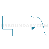
Outline

Summary
| Unique Area Identifier | 613621 |
| Name | Loup Precinct |
| County | Merrick County |
| State | Nebraska |
| Area (square miles) | 56.13 |
| Land Area (square miles) | 56.03 |
| Water Area (square miles) | 0.10 |
| % of Land Area | 99.82 |
| % of Water Area | 0.18 |
| Latitude of the Internal Point | 41.22727780 |
| Longtitude of the Internal Point | -98.21962900 |
Maps


Graphs
Select a template below for downloading or customizing gragh for Loup Precinct, Merrick County, Nebraska


Neighbors
Neighoring Voting District (by Name) Neighboring Voting District on the Map
- CLFWE Precinct, Nance County, NE
- CTS Precinct, Nance County, NE
- Mead Precinct, Merrick County, NE
- Midland Precinct, Merrick County, NE
- Prairie Creek Precinct, Merrick County, NE
- Spring Creek Precinct, Howard County, NE
- St. Paul Ward 2, Howard County, NE
Top 10 Neighboring County Subdivision (by Population) Neighboring County Subdivision on the Map
- Loup township, Merrick County, NE (753)
- Prairie Creek township, Merrick County, NE (348)
- Gage Valley precinct, Howard County, NE (230)
- Midland township, Merrick County, NE (211)
- Mead township, Merrick County, NE (170)
- Spring Creek precinct, Howard County, NE (169)
- Cottonwood township, Nance County, NE (73)
- West Newman township, Nance County, NE (66)
- South Branch township, Nance County, NE (39)
Top 10 Neighboring Place (by Population) Neighboring Place on the Map
Top 10 Neighboring Unified School District (by Population) Neighboring Unified School District on the Map
- Central City Public Schools, NE (4,655)
- St. Paul Public Schools, NE (3,613)
- Greeley-Wolbach Public Schools, NE (1,153)
- Palmer Public Schools, NE (1,080)
Top 10 Neighboring State Legislative District Upper Chamber (by Population) Neighboring State Legislative District Upper Chamber on the Map
Top 10 Neighboring 111th Congressional District (by Population) Neighboring 111th Congressional District on the Map
Top 10 Neighboring Census Tract (by Population) Neighboring Census Tract on the Map
- Census Tract 9661, Nance County, NE (3,735)
- Census Tract 9667, Merrick County, NE (2,615)
- Census Tract 9666, Merrick County, NE (1,947)
- Census Tract 9705, Howard County, NE (1,694)